1778 French Land Plan Including Sketch and Reference Material
10231On offer is an excellent example of a land plan and description dating from April, 1778.
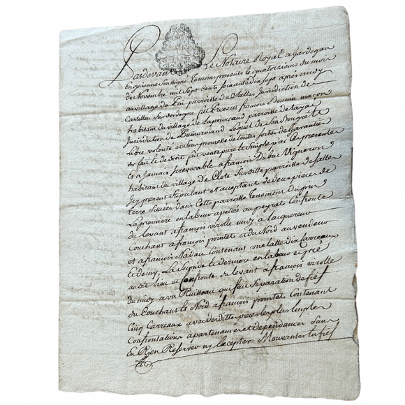
The document consists of a detailed eight page description and a one page sketch map of the land plot in question. The pages detail an agreement between Pierre Alexandre de Sorbiers and Louis Antoine Bourdin. The document comprises eight pages of notes and one page depicting a map of the land being referenced. They are sewn together with a light twine and the map drawing is attached to it with twine as well.
The document is titled: Tableau de Descriptions, [ ] et Observations Necessaires a l'Intelligence du Plan au Present Protes
[Translation: Verbal Table of descriptions, [] and observations necessary for the intelligence of the plan to the present verbal report]
It is divided into 13 paragraphs, each lettered from A to N. There are cross-references in the text to various paragraphs. Our informal research has not been able to turn up any additional information about the two men referenced in the document.
For a lawyer or property planner, this is an excellent example of the type of property agreements dating from late 18th century France.
The document is 100% complete. The 8 pages measure 10 inches by 8.0 inches. The pages show wear marks around the edges. The handwriting is copperplate and is legible although it has faded in places.
Please don't hesitate to contact us for more information or to request photos. (Kindly include the SKU, listed on this page above the price, in your e-mail so we can more easily answer your questions.)